 |
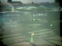
A view through the mobile user's see-through
head-worn display. The image shows labels of buildings and virtual
flags, denoting points of interest, as seen from the top of a campus
building. (This and all other augmented reality images were captured
by a video camera aimed through the see-through head-worn display.)
|
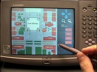 |
The hand-held computer with a map interface
|
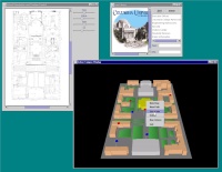 |
The Indoor Command Center Interface: a) Desktop UI, showing
(clockwise from lower right) main model window, map window,
information window.
|
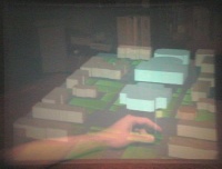 |
The Indoor Command Center Interface: b) Immersive
augmented reality UI. The user positions a virtual flag by moving its
position-tracked physical base.
|
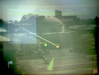 |
An in-place menu realized with a screen stabilized menu
and a leader line
|
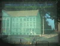 |
3D model of a building that once occupied Columbia's campus, overlaid
on its former site.
The building is the main tract of the "Bloomingdale Asylum for
the Insane", that occupied the area of Columbia's Low Library through
the first part of the 19th century.
|
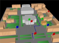 |
Paths as a UI mechanism to guide outdoor users: a)
creating a path in the desktop UI
|
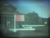 |
Paths as a UI mechanism to guide outdoor users: b) same path as in
(a), seen outdoors from ground level
|
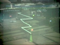 |
Paths as a UI mechanism to guide outdoor users: c) same path as in (a)
and (b), seen outdoors from above
|
T. Höllerer, S. Feiner, T. Terauchi, G. Rashid, D. Hallaway,
Exploring MARS: Developing Indoor and Outdoor User Interfaces to a
Mobile Augmented Reality System , In: Computers and Graphics,
23(6), Elsevier Publishers, Dec. 1999, pp. 779-785

